This time I want to tell you something about a project where I’m participating lately. It’s called the OpenStreetMap. The idea behind OpenStreetMap is to build a free map of the world.
When Google introduced its Webservice Google Maps and and their software Google Earth everybody was excited what you can do with that. The most important thing: You can share geographic information with others. Like geotagging your pictures on Flickr and displaying them on a map, or describing all your favourite pubs and sites.
Now there are several drawbacks with Google Maps (and similar services like MSN Live): It’s copyrighted data, you can’t use it for everything because you have to sign a License Agreement. And you can’t change the data itself. Furthermore, Google Maps is not ideal for me, because it’s optimized for car users. There are even maps for all the underground parkings in Vienna but no Cycle Routes or Public Transport routes.
Now, there’s an alternative: The OpenStreetMap (short: OSM), a free editable map of the whole world. The availability of GPS receivers made it possible, because volunteers record their tracks and draw the map by tracing the tracks and adding additional information like street names, road types and amenities (like shops, post offices, pubs, cycle parkings, …). Additional to volunteer work some other information sources has been used, like governmental databases.
The result: A yet far from complete but usable map. And it looks nice. And you can access the raw data which is available under a Creative Commons Licence and even allows commercial usage. Here’s an example from Vienna’s city centre, you can see the the area around the Imperial Palace and the Museumsquarter. The first picture is taken from Google Maps, the second from MSN Live (how comes the name „2ER Linie“ is used – that’s a commonly used but unofficial name) and the third from the OSM (rendered with the preferred renderer Mapnik).
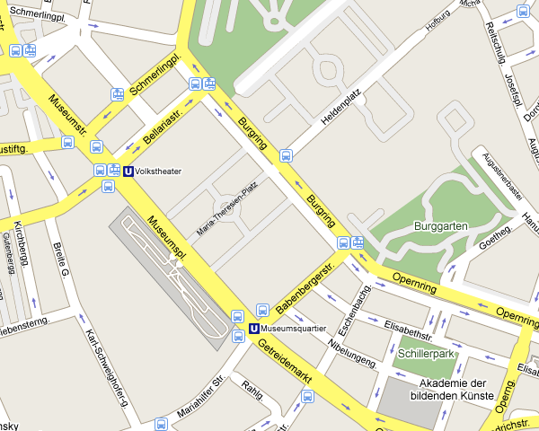 Google Maps |
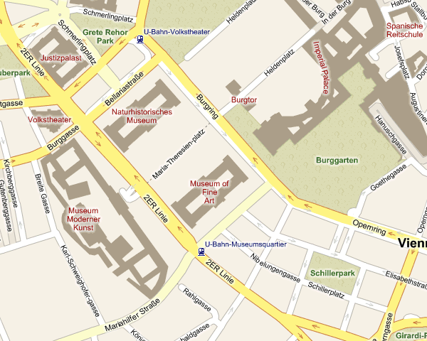 MSN Live |
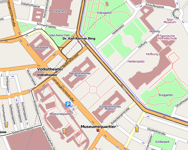 OpenStreetMap |
Which is really exciting about the OSM are the projects that emerge from it:
* The Cycle Map: A special view of OSM optimized for cyclists.
* OpenPisteMap: A project to track skiing pistes and all things that are important for skiiers like lifts, restaurants, shops and so on.
* OpenRouteService: A route planner using OSM data.
and there’s much more …
If you want to learn more about OSM than take a look at their Wiki. There are some howto’s how to contribute to OSM … you don’t even need a GPS receiver for this.